



How to Use
How to Use
KYOTO Transit Planner is an easy-to-use free search application offering information on available routes, timetables and fares for city buses and rail services in Kyoto City, simply by entering point of departure and destination.
System Requirements
- Google Chrome (latest version)
- Microsoft Edge (latest version)
- Safari (latest version)
Available Departure and Destination Setting Coverage
- Rail and Bus routes, stations and stops in Kyoto City
- Sightseeing, Accommodation, Souvenir, Stores, Dining in Kyoto City
- Selected locations on the map of Kyoto City
Railway Lines
| Rail Operator | Coverage |
|---|---|
| Kyoto Subway Line | All Lines (Karasuma Line; Tozai Line) |
| Kintestu | Kyoto Line |
| Keihan | Keihan Main Line; Keishin Line; Uji Line |
| Hankyu | Kyoto Line; Arashiyama Line |
| Randen (Keifuku Electric Railroad) | All Lines (Arashiyama Line; Kitano Line) |
| Eiden (Eizan Electric Railway) | All Lines(Eizan Main Line; Kurama Line) |
| Sagano Scenic Railway | All Lines ("Torokko" - Sagano Scenic Railway) |
| Tantetsu (Kyoto Tango Railway) | All Lines (Miyafuku Line; Miyamai Line; Miyatoyo Line) |
| JR West | Kyoto Line; Biwako Line; Sagano Line; San-in Line; Nara Line; JR Touzai-Gakkentoshi Line; Yamatoji Line; Kansai Line; Maizuru Line; Obama Line (Stations inside Kyoto prefecture) |
Bus Lines
| Bus Operator | Coverage |
|---|---|
| Kyoto City Bus | All Routes |
| Kyoto Bus | All Routes |
| Keihan Bus | Keihan Bus Yamashina Business Office |
| Keihan Kyoto Kotsu | Kyoto city area (excluding some routes) and routes between Kyoto city to Kameoka city |
| West JR Bus | Takao Keihoku Line |
| Hankyu Bus | Oharano Line; Nagaokakyo Line (only part) |
| Yasaka Bus | All Routes |
| Daigo Community Bus | All Routes |
| Kyoto Rakunan Express | All Routes |
| Kyoto Night Cruise (Yoru) Bus | Gion Night Cruise (Yoru) Bus; Kawaramachi Night Cruise (Yoru) Bus |
Search by Letter
Search information on Kyoto City rail and bus routes, travel times and fares.
(1) Enter "Point of Departure" and "Destination".
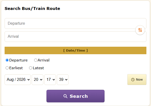
- Bus Stop, Station Name or Location can be entered.
- Possible search results will appear as you type part of full names.
- "Point of Departure" and "Destination" can be swapped.
(2) Enter Specific Times and Conditions.
- Intended "Departure" and "Arrival" times can be entered.
- "Earliest" and "Latest" search options available.
(3) Press "Search" Button.
(4) Search Results will be displayed.
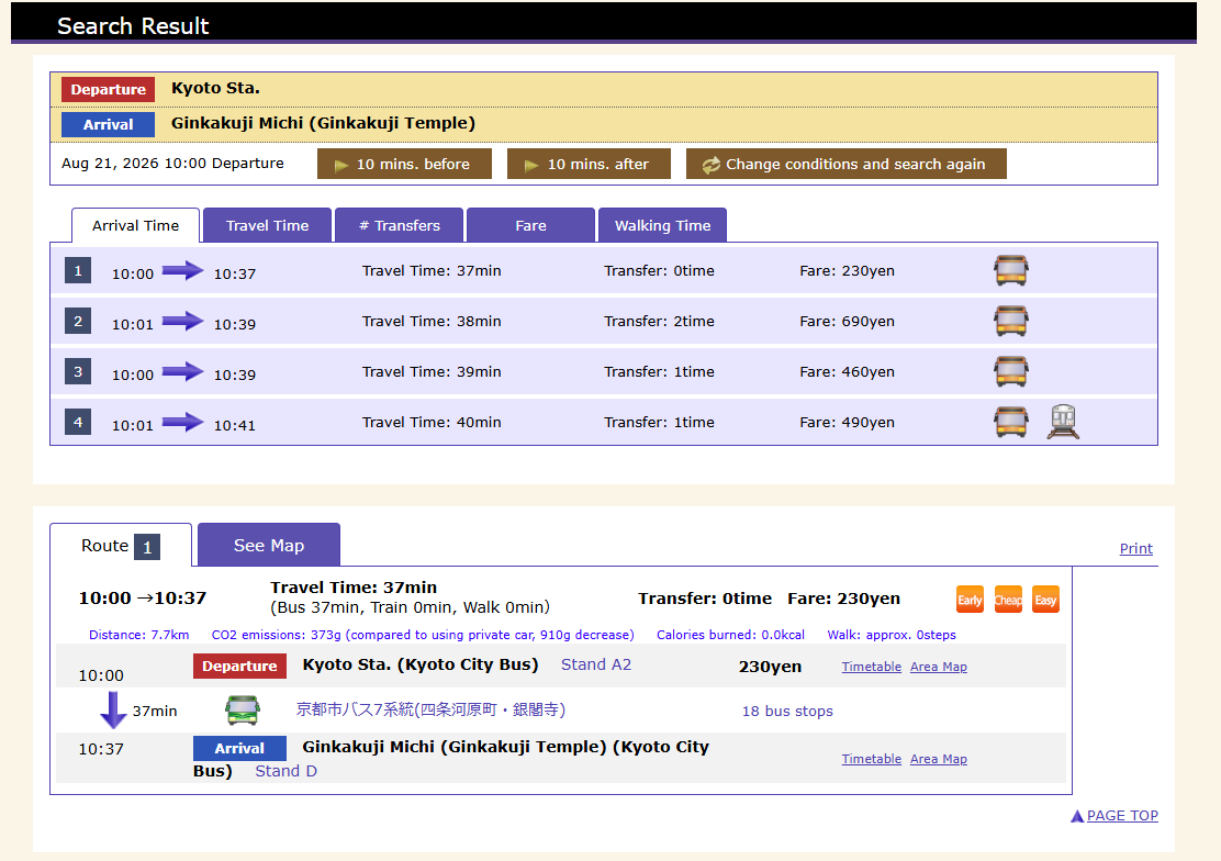
NOTES on Icons
 |
Bus |  |
Railway |  |
Slow walking pace |  |
Normal walking pace |  |
Fast walking pace |
 |
Fastest arrival |  |
Cheapest fare |  |
Comfortable travel |
Details of bus and railway
 |
Kyoto City Bus |  |
Kyoto Bus |  |
Keihan Bus |  |
Keihan Kyoto Kotsu |  |
Hankyu Bus |
 |
West JR Bus |  |
Yasaka Bus |  |
Daigo Community Bus |  |
Kyoto Rakunan Express |  |
Gion/Kawaramachi Night Cruise (Yoru) Bus |
 |
Kyoto Subway Line |  |
Keihan |  |
Hankyu |  |
Kintestu |  |
Randen (Keifuku Electric Railroad) |
 |
Eiden (Eizan Electric Railway) |
 |
Sagano Scenic Railway |  |
JR West |
Map Search
Search information on Kyoto City rail and bus routes, travel times and fares.
(1) Enter "Point of Departure" and "Destination".
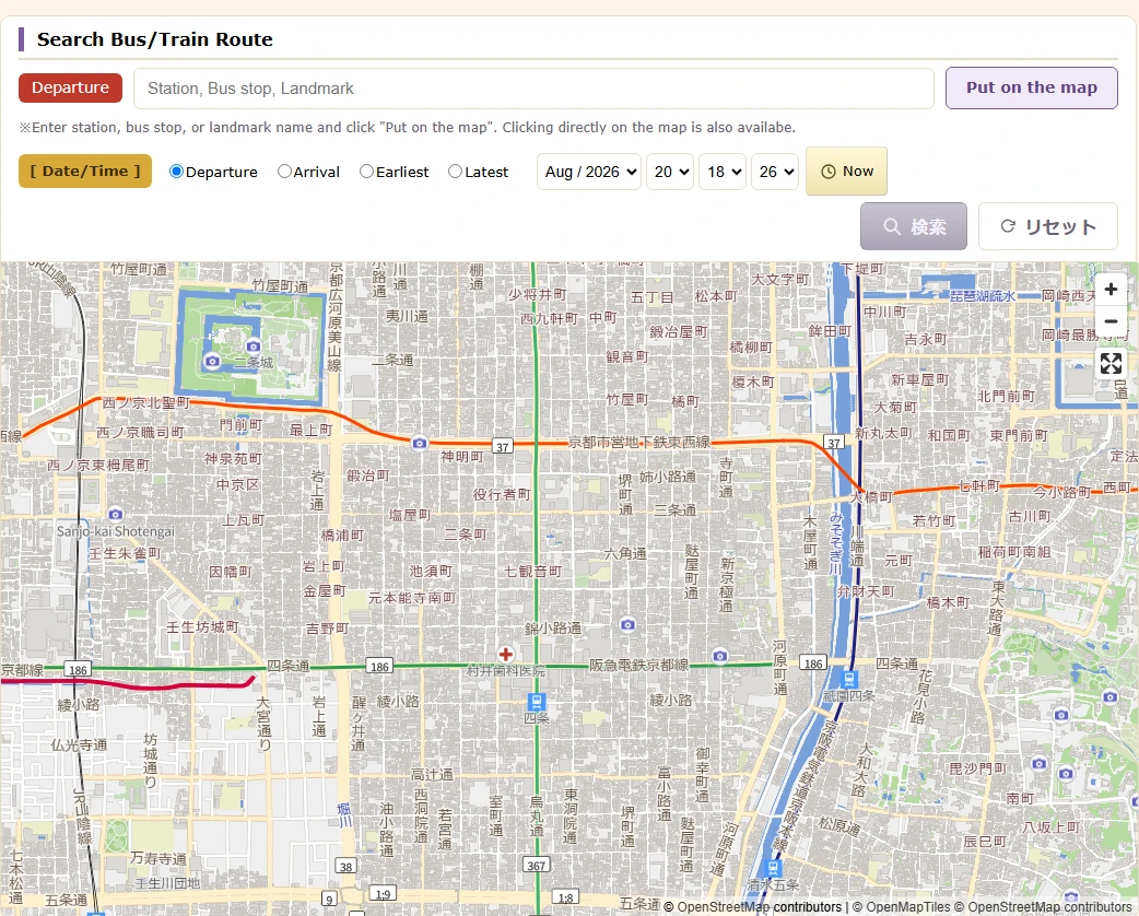
- Location can be chosen as "Point of Departure" by clicking on the map. "Point of Departure" can be reset by clicking on the "Point of Departure" icon.
- After "Point of Departure" has been chosen, "Destination" can be chosen by clicking a location on the map. "Destination" can be reset by clicking on the "Destination" icon.
- Both "Point of Departure" and "Destination" can be reset by pressing the [Reset] button.
- Locations can be searched by entering addresses direct.
(2) Enter Specific Times and Conditions.
- Intended "Departure" and "Arrival" times can be entered.
- "Earliest" and "Latest" search options available.
(3) Press "Search" Button.
Station Maps
Maps of train stations in Kyoto City can be searched.
(1) Choose railway operator or station name.
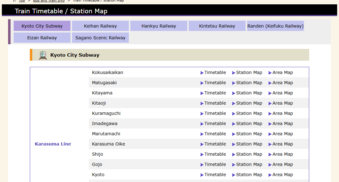
- When choosing a railway operator, a list of station names for each line will be displayed.
- On pressing the "Station Map" link of the selected station, you will transfer to map page.
(2) Pressing the button to the left, select the floor you wish to view.
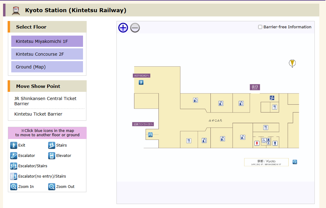
- Station maps can be viewed by floor.
- Pressing the ticket barrier will move it to the centre of the screen.
- Pressing the [ + / - ] at the top of the station map screen, "Zoom in and Zoom out" option available.
(3) Browse maps.
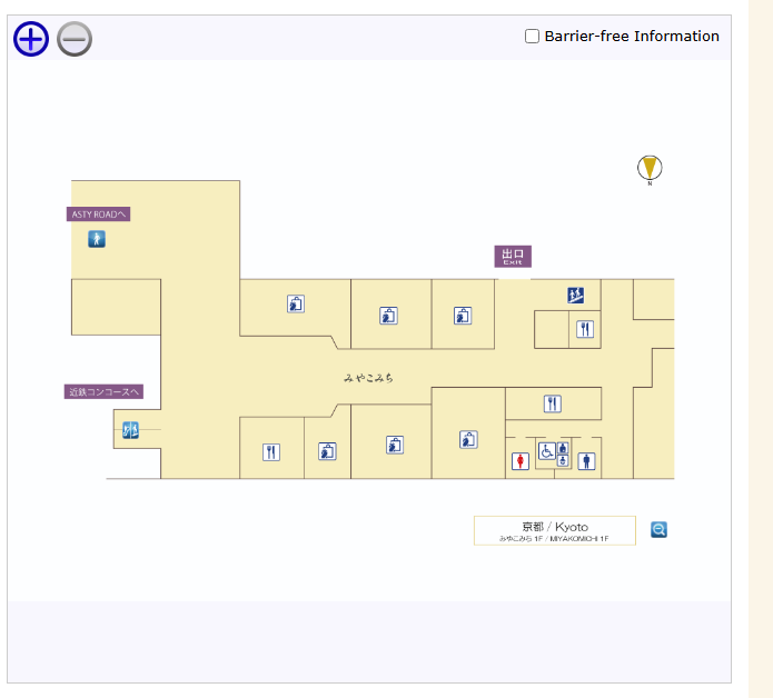
- Arrow will appear when placing mouse pointer on icon. If you press the upper arrow, you will move up a floor. If you press the lower arrow, you will move down a floor. No arrow will appear when moving on the same floor. Human character figure will appear at destination.
- When connected to outside the station, will transfer to a screen map.
- Location can be changed by dragging the station map.
- When stations are connected, possible to transfer between station maps. (e.g. Subway Shijo station - Hankyu Karasuma station etc.)
NOTES
Map Icons
 |
Wheelchair-accessible (meeting barrier-free standards) |
 |
Slope (not meeting barrier-free standards) |
 |
Ticket Counter |  |
Station Office |  |
Public Telephone |
 |
Coin Locker |  |
Disabled Toilet |  |
Gentlemen |  |
Ladies |  |
Baby Seat |
 |
Ostomate |  |
Shops |  |
Restaurants |  |
Bicycle Parking |  |
Exit |
 |
Stairs |  |
Escalator |  |
Elevator |  |
Escalator/Stairs |  |
Ticket Barrier |
 |
Platform No. |  |
AED (Automated External Defibrillator) |  |
Go Downstairs |
Floor Move Icons
 |
Exit |  |
Stairs |  |
Escalator |  |
Elevator |  |
Escalator / Stairs |
 |
Escalator (No Entry) / Stairs |  |
Zoom In |  |
Zoom Out | ||||